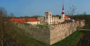
Põltsamaa Castle
castle in Estonia...

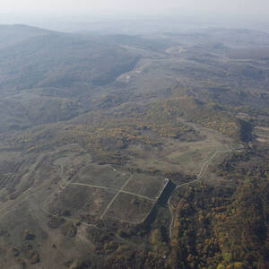
The Struve Arc is a chain of survey triangulations stretching from Hammerfest in Norway to the Black Sea, through 10 countries and over 2,820 km. These are points of a survey, carried out between 1816 and 1855 by the astronomer Friedrich Georg Wilhelm Struve, which represented the first accurate measuring of a long segment of a meridian. This helped to establish the exact size and shape of the planet and marked an important step in the development of earth sciences and topographic mapping. It is an extraordinary example of scientific collaboration among scientists from different countries, and of collaboration between monarchs for a scientific cause. The original arc consisted of 258 main triangles with 265 main station points. The listed site includes 34 of the original station points, with different markings, i.e. a drilled hole in rock, iron cross, cairns, or built obelisks.
Slug: whc-struve-geodetic-arc
relatedTo:
isChildOf:
Location:
Created At: Tue Jan 21 2025 20:51:26 GMT+0100 (Central European Standard Time)
Updated At: Fri Feb 20 2026 16:25:32 GMT+0100 (Central European Standard Time)
Created By:
Version: 1
Status: test_v1
castle in Estonia...
The Hallstatt-Dachstein/Salzkammergut region is a breathtaking alpine landscape in Austria,...
The vast natural forest of Yellowstone National Park covers nearly...
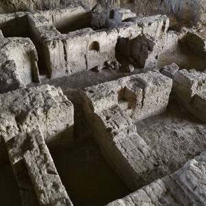
Situated on the coastal dunes in Nuseirat Municipality, the ruins...
This serial property contributes to the understanding of the origin...
The serial property, located in the Highland Region of Scotland,...
The property is a rural settlement in northern Jordan that...
Surrounded by a remnant coastal forest, away from the coastline,...
From 500 BCE on, the Roman Empire extended its territory...
The archaeological remains of ancient Hegmataneh are located in northwestern...
Running north to south through the heart of historical Beijing,...
The property is an earthen architectural complex established since the...