Envoie le lien. Dans le chat et les e-mails, le titre et la photo de l'article s'affichent.
https://mostlyharmless.travel/articles/kutha
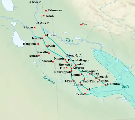
Map of the main cities of Lower Mesopotamia during the Ur III period (c. 2100-2000 BC), with the approximate course of the rivers and the ancient shoreline of the Gulf.
Author: Near_East_topographic_map-blank.svg: Sémhur derivative work: Zunkir (talk), License: CC BY-SA 3.0
·
Source
La registration est actuellement uniquement possible avec un code d'invitation. Veuillez entrer votre code d'invitation ou utiliser votre lien d'invitation personnel. Si vous n'avez pas de code, vous pouvez en demander un auprès de nous.
 alpha
NOW FEDERATED!
alpha
NOW FEDERATED!