Stuur de link door. In chat en e-mail verschijnen de titel en foto van het artikel erbij.
https://mostlyharmless.travel/articles/kutha
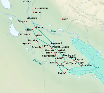
Map of the main cities of Lower Mesopotamia during the Ur III period (c. 2100-2000 BC), with the approximate course of the rivers and the ancient shoreline of the Gulf.
Author: Near_East_topographic_map-blank.svg: Sémhur derivative work: Zunkir (talk), License: CC BY-SA 3.0
·
Bron
Registreren kan momenteel alleen met een uitnodigingscode. Vul je code in of gebruik je persoonlijke uitnodigingslink. Heb je geen code, dan kun je er een bij ons aanvragen.
 alpha
NOW FEDERATED!
alpha
NOW FEDERATED!